From pipeline corridor risk assessment to city-wide utility mapping — HRP Infra, based in Ahmedabad, Gujarat, transforms raw geographic data into precise engineering intelligence trusted by India's leading infrastructure organisations.
HRP Infra Pvt. Ltd. is an Ahmedabad-headquartered multi-discipline engineering consultancy with a dedicated GIS division. We combine field survey expertise with advanced geospatial technology to deliver spatial data solutions that support project planning, operation, and regulatory compliance across India.
Our workflows conform to CPHEEO guidelines, BIS standards, OISD norms, and Survey of India geospatial frameworks — giving clients auditable, standards-compliant deliverables.
Comprehensive geospatial solutions designed for oil & gas pipelines, city gas distribution, water infrastructure, and urban planning — across Ahmedabad, Gujarat, and nationally.
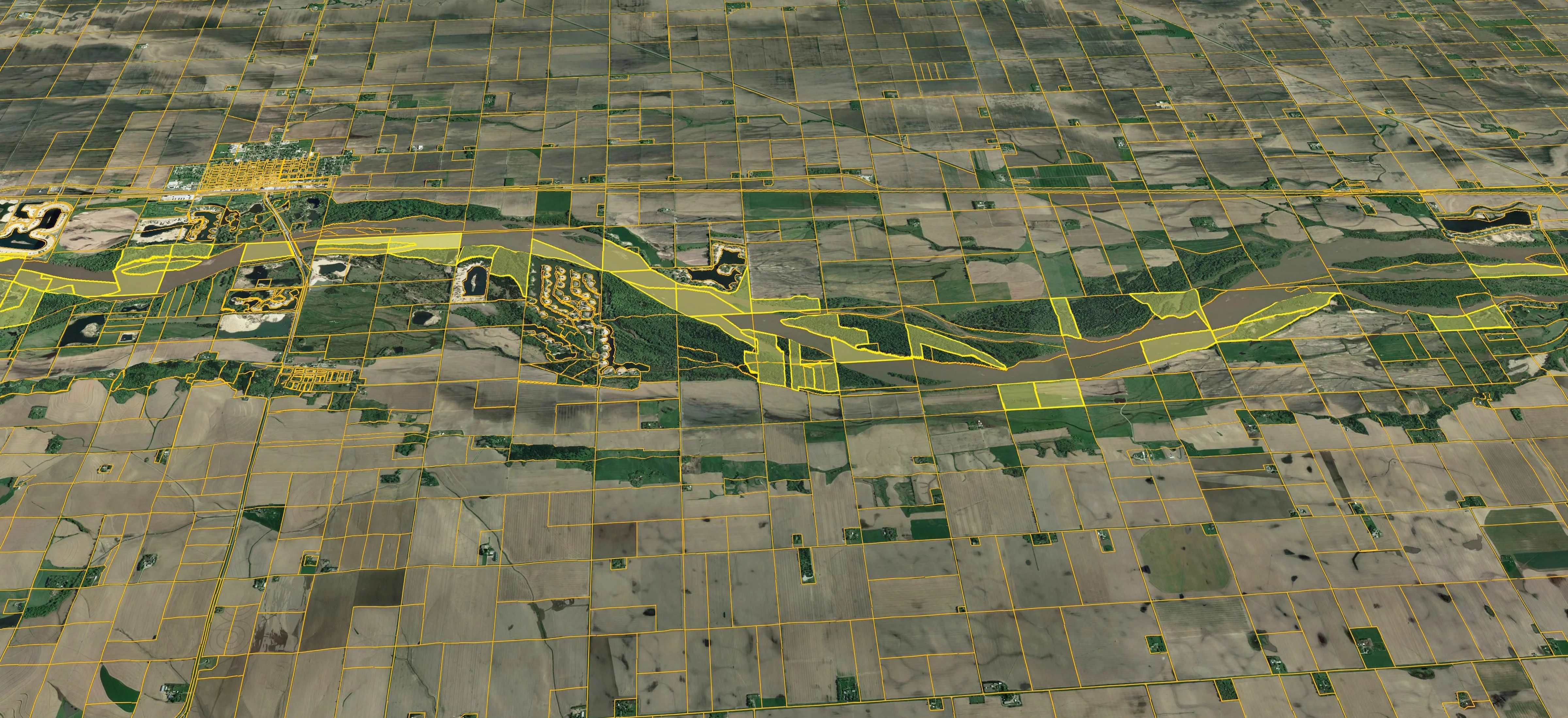
End-to-end GIS mapping of oil, gas, water, and utility pipeline corridors with detailed asset attributes, right-of-way documentation, and risk zone delineation aligned to PNGRB and OISD standards.
Spatial cataloging of above-ground and underground infrastructure assets — valves, chambers, meters, crossings — with full attribute tables, photographs, and condition grading for lifecycle management.
Satellite imagery interpretation and ground-truth survey for land use / land cover (LULC) classification supporting environmental clearances, urban planning, and route corridor analysis.
Comprehensive mapping of underground utilities (water, sewer, electricity, telecom) using GPS, EML, and as-built drawing integration — preventing conflicts and enabling safe excavation planning.
Development of enterprise-grade spatial databases (PostgreSQL/PostGIS, ESRI Geodatabase) with structured schemas, data validation rules, and advanced querying for engineering analysis.
Custom online GIS portals and dashboards for real-time infrastructure visualization, multi-user field data collection, and stakeholder reporting — accessible on desktop and mobile.
As a multi-discipline consultancy based in Ahmedabad, we combine on-ground survey expertise with advanced geospatial technology — delivering GIS data that drives real engineering decisions.
All GIS outputs conform to CPHEEO, BIS, OISD, and PNGRB norms, ensuring regulatory acceptability for DPR submissions and audits.
From GPS field survey and drone photogrammetry to database development and web-GIS deployment — all under one roof in Gujarat.
Our in-house GIS asset management platform enables clients to manage their infrastructure lifecycle beyond project delivery.
Successfully delivered GIS projects for IOCL, Adani Total Gas, and Rudra Gas across Gujarat, UP, Assam, and Rajasthan.
A structured, quality-assured process from project kick-off to final deliverable handover.
Scope definition, data requirement gathering, and compliance mapping with applicable standards.
GPS/GNSS survey, drone imagery, and as-built drawing integration for ground-truth accuracy.
Data cleaning, topology validation, attribute enrichment, and multi-level quality checks.
Structured spatial database creation with defined schemas, metadata, and domain rules.
Web GIS portal setup, stakeholder training, and post-delivery support for seamless adoption.
Real-world GIS mapping projects executed for India's largest oil & gas and utility companies — from Gujarat to Assam.
Indian Oil Corporation Limited
GPS-based corridor mapping across multiple states generating population density index for pipeline right-of-way risk classification and PNGRB compliance reporting.
Rudra Gas Pvt. Ltd.
Complete GIS database creation for the entire CGD network in the Kota Geographical Area — spatial representation of assets, valve locations, pressure zones, and service connections.
Adani Total Gas Limited
As-built GIS mapping and digital twin creation for CGD infrastructure across Gujarat, Uttar Pradesh, Assam, and Rajasthan — enabling real-time asset lifecycle management.
Beyond mapping, HRP Infra develops purpose-built GIS software products to help clients manage their infrastructure post-project.
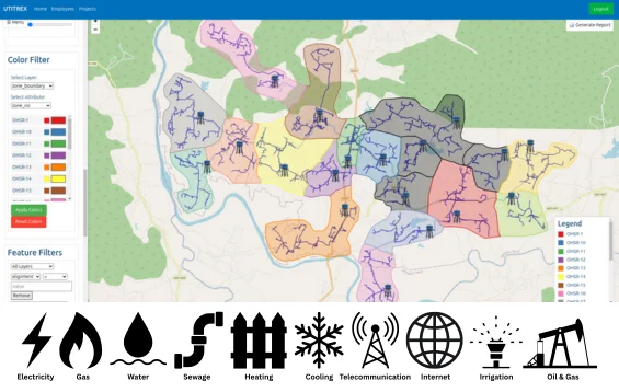
A web-based GIS asset management platform for water, drainage, stormwater, and oil & gas pipeline networks. Manages the complete project lifecycle — from Design and Execution through to Operations and Maintenance.
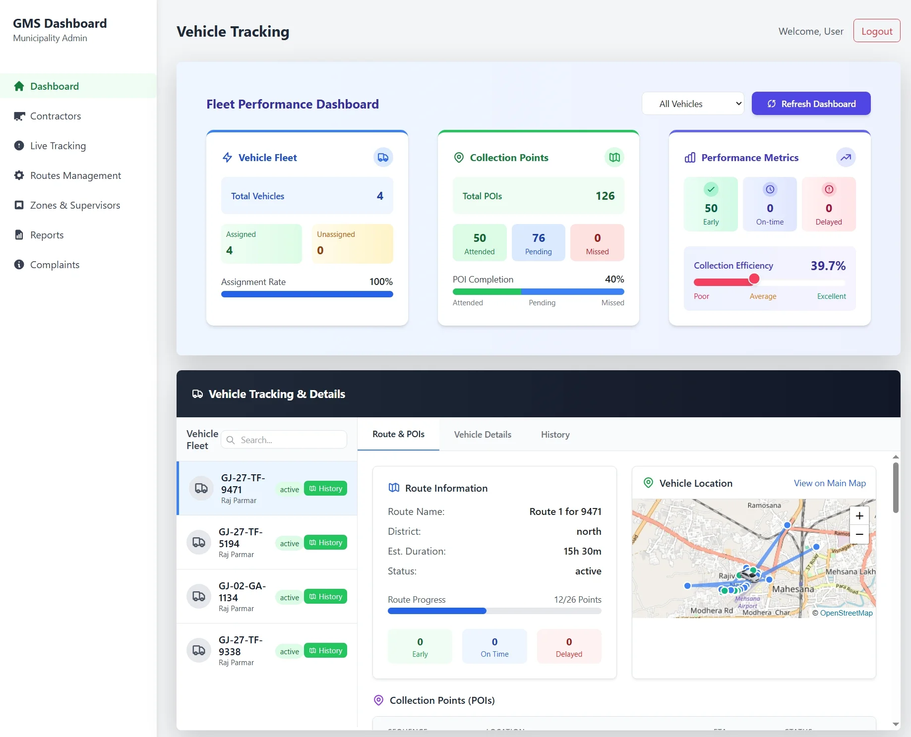
A web-based GIS application for daily waste collection management with Point of Interest (POI) tracking, route optimization, and mobile app integration for field staff in urban local bodies across Gujarat.
HRP Infra's GIS practice is backed by certified professionals, industry-standard software, and adherence to national geospatial norms.
ESRI-trained and experienced GIS analysts with domain expertise in oil & gas, water, and urban infrastructure.
ArcGIS, QGIS, AutoCAD Map 3D, Global Mapper, Leica GPS, and DJI drone systems for accurate spatial data capture.
GIS deliverables meet Central Public Health & Environmental Engineering Organisation and Bureau of Indian Standards specifications.
Headquartered in Ahmedabad, Gujarat with proven project execution across multiple Indian states and union territories.
Quick answers about HRP Infra's GIS mapping capabilities and processes.
Explore related services and resources
Talk to HRP Infra's GIS experts in Ahmedabad today. We'll scope your project, recommend the right spatial solution, and deliver with precision.